Türkiye launches AI-powered geohazard platform
Türkiye will use an artificial intelligence-powered platform to monitor geological risks that could affect critical infrastructure and superstructures across the country.
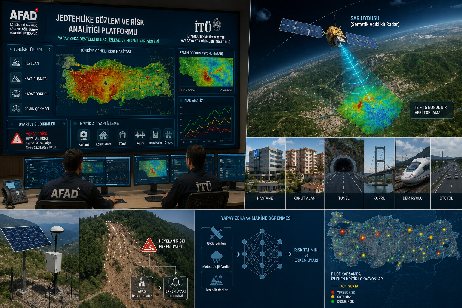
The project, developed jointly by the Istanbul Technical University (ITU) Eurasia Institute of Earth Sciences and the Disaster and Emergency Management Authority (AFAD), will monitor geological hazards through the AI-powered Geohazard Monitoring and Risk Analytics Platform, CE Report quotes Anadolu Agency.
The system, launched as a pilot under the AFAD–ITU National Geohazard Monitoring and Risk Analytics Platform protocol, aims to monitor, assess, and reduce geological risks affecting critical infrastructure nationwide.
Prof. Dr. Tolga Görüm, Director of the ITU Eurasia Institute of Earth Sciences, said the project’s primary goal is to establish a national-scale geohazard monitoring platform, particularly for critical infrastructure.
The platform is designed for both existing and planned infrastructure and superstructure projects across Türkiye. It uses remote sensing technologies such as LiDAR and InSAR to support planning, identify geological risks early, and enable preventive measures before hazards develop.
Supported by the Presidency of Strategy and Budget, the three-year project is expected to be expanded through follow-up initiatives.
The platform will monitor landslides, rockfalls, karst sinkholes, and subsidence caused by groundwater level changes at critical sites including hospitals, residential areas, tunnels, bridges, railways, and highways using satellite observations.
Synthetic Aperture Radar (SAR) satellite data collected every 12 to 16 days will be analyzed to detect ground deformation.
Combining machine learning and artificial intelligence, the platform will continuously monitor geological hazards in both space and time while providing early warnings to AFAD and other relevant institutions. It also aims to establish the foundation for a national early warning system.
After identifying high-risk areas across Türkiye, ground-based monitoring infrastructure will be installed to ensure continuous surveillance and early detection of potential hazards. ITU is also preparing to establish a dedicated research center, which will provide public institutions with web-based access to deformation data and geohazard analyses.
Prof. Dr. Görüm said the platform will support both existing and future infrastructure projects by monitoring hazards such as landslides, rockfalls, sinkholes, and ground subsidence throughout their planning and operational phases.
He noted that even areas showing no current deformation could become hazardous in the future, making early risk identification and preventive action essential.
The system will also combine deformation data with hydrometeorological indicators to forecast future disaster risks. Machine learning models will analyze how extreme and cumulative rainfall has triggered landslides in the past, helping predict similar events and reduce future risks.
Following the signing of the protocol last week, the pilot project officially entered operation. More than 40 critical locations across Türkiye are already being monitored in cooperation with AFAD.
AFAD also plans to establish its own landslide monitoring and early warning center. Currently, landslide activity is being monitored in several regions, including Hakkari, Tortum, and İzmir, with weekly reports provided to AFAD.
Photo: Chat GPT